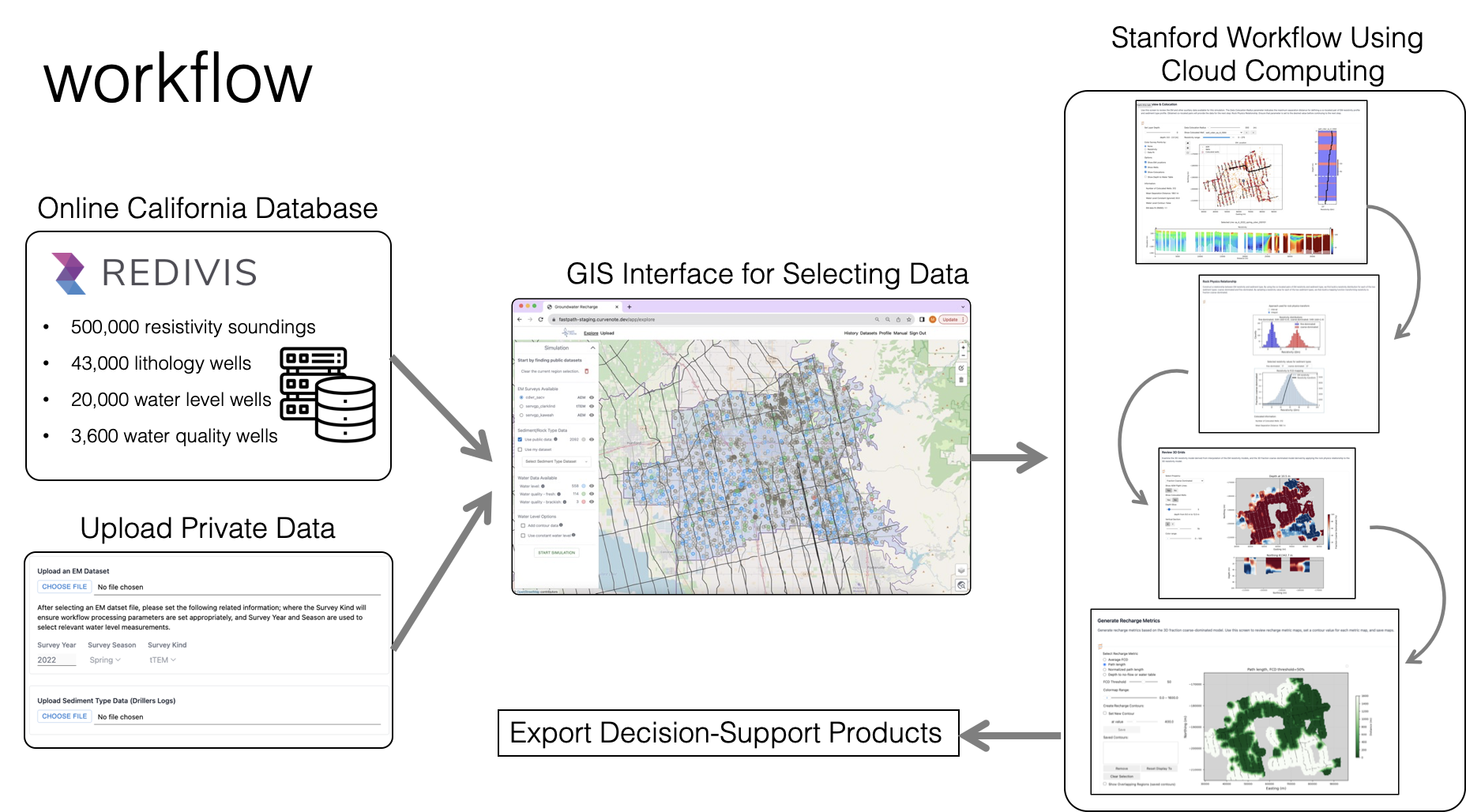
Fastpath web-based application
Identifies permeable pathways in geophysical data to select sites for managed aquifer recharge.

Innovation in Managed Aquifer Recharge
The fastpath web-based application uses geophysical data, driller’s logs, and proprietary modeling to map permeable pathways in a specific area, enabling the selection of sites for surface-spreading managed aquifer recharge without drilling.
Features
Provides a guided analysis of data through an easy-to-use user interface
The only application that enables users to go from acquired geophysical data to actionable data
Provides a planview display of metrics including:
- total percentage of coarse-grained material
- length of permeable pathways from the ground surface to the water table
- depth to first clay layer or water table, to assess the risk of ponding
Users can upload their own data, or utilize the existing database.
Results can be exported for use in standard GIS systems.
Users can explore uncertainty in the derived metrics.
Developed by the Stanford Environmental Geophysics Research Group with funding from Stanford Doerr School of Sustainability Accelerator.

App Development Leads
 | Seogi Kang |
 | Steve Purves |
Contact
Project web-page: https://fastpath.stanford.edu
Contact email: fastpathcontact@stanford.edu